Postdoctoral Research Assistant in Robotic Navigation and Mapping
Postdoctoral Research Assistant in Robotic Navigation and Mapping
- Deadline: 9th December 2020
- Apply Here
We are seeking a full-time Postdoctoral Research Assistant to join the Dynamic Robot Systems Group, part of the Oxford Robotics Institute and the Department of Engineering Science, University of Oxford (Central Oxford). The post is funded by the Engineering and Physical Sciences Research Council (EPSRC) and is fixed term for 12 months in the first instance.
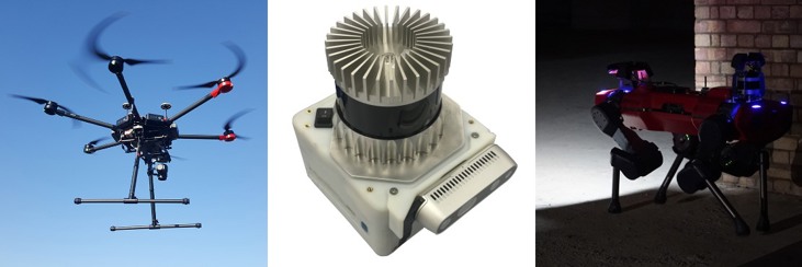
You will develop mapping and reconstruction algorithms suitable for navigation in challenging field environments by fusing vision, LIDAR and inertial sensing. You will be responsible for the development and evaluation of algorithms intended for our robots - our ANYmal C quadruped robot and a DJI Matrice aerial drone (below). The vision of our group is to achieve reliable multi-sensor navigation on computationally constrained platforms moving dynamically in challenging lighting conditions. It is intended that the successful candidate will lead our new aerial inspection project.
You should hold a PhD/DPhil (or be near completion) in robotics, computer vision, machine learning or closely related field. You should have an excellent academic track record in topics relevant to robotics, visual navigation, visual inertial navigation (VINS), mapping (SLAM), path and motion planning or related areas. Ideally you should have experience working with real robots and have experience working in a team. Experience working with legged locomotion or drones would be desirable but not expected.
Informal enquiries may be addressed to Dr Maurice Fallon (mfallon@robots.ox.ac.uk).
You will be required to upload a covering letter/supporting statement, including a brief statement of research interests (describing how past experience and future plans fit with the advertised position), CV and the details of two referees as part of your online application.
The following are relevant recent publications/works from our group:
- VILENS - Multi-Sensor tightly-fused odometry – project – paper – video
- Large Scale Real-Time LIDAR SLAM – project – paper – video1 – video2
- Elastic LIDAR Reconstruction for Exploration – paper – video
- Autonomous underground exploration with ANYmal C – video
Keywords: robotics, navigation, mapping, SLAM, legged robots, aerial robots
Apply Here